JAMESTOWN – As we’ve been discussing all week, a complex storm system is set to impact Western New York over the weekend with very mild temperatures and the potential for flooding rain in combination with ice and snow melt.
The National Weather Service maintains the Areal Flood Watch for much of Western New York (minus Allegany County), going into effect at 1 p.m. Saturday afternoon and running through 1 p.m. Sunday afternoon.

There is also now a High Wind Watch in effect for the same areas, starting at 4 a.m. Sunday morning and running through 4 p.m. Sunday afternoon for wind gusts near 60 MPH at times.

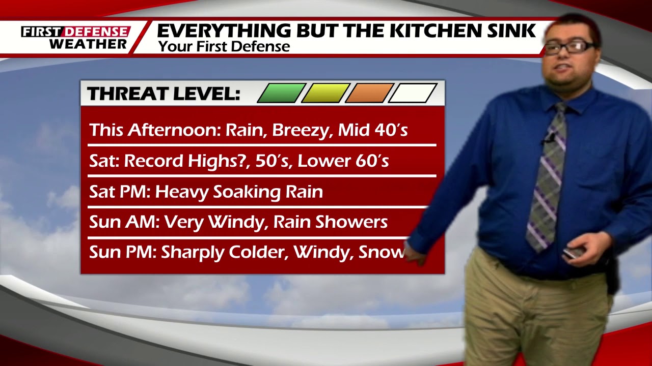
Rain will continue to overspread the region through this afternoon. There could be some pockets of moderate to heavy rainfall times. It will also be breezy with wind gusts possibly near 30 MPH times. Highs today 42 valleys, 49 lakeshore.
Current model guidance has suggested there could be some breaks in the rain overnight, possibly even turning to scattered showers for the morning hours. It will remain windy through the overnight, Lows 40 to 46.
The heaviest amounts of the rain will come Saturday afternoon as a frontal boundary stalls out over the region. This will also usher in very mild air into Southern Tier. Most everybody will be in the mid to upper 50’s with some lower 60’s possible, especially near the Lake Erie shoreline. The record high for the city of Jamestown for Saturday is 55, set in 1975.
Heavy rain will continue into Sunday morning with the wind really picking up in the morning hours. Some wind gusts could reach 60 MPH before the winds settle down in the afternoon. Highs will also occur early in the day before colder air invades the region, dropping temps into the 30s for Sunday afternoon.

Depending on the exact timing of cold air arrival, we may turn over to a brief window of wintry precipitation before changing over to all snow for Sunday night.
When we’re all set an done, we are looking at rain totals ranging from 1 to 2 inches acorns the Southern Tier with localized higher amounts possible. When combined with he onset of rapid ice and snow melt from the warmer temperatures, this will elevate the risk of areal flooding.

If you live in a flood prone area, make sure to pay attention to all flood warnings should bthey be issued through the weekend.

WNYNewsNow is a proud Ambassador for the NOAA Weather-Ready Nation program.
![]()


Leave a Reply