App users, tap here to watch video.
JAMESTOWN – After the passage of a Cold front, on and off showers have been prevalent throughout the day with temperatures going the opposite direction. We’ll squeak out a couple mainly dry days before more rain returns to the region on Friday.
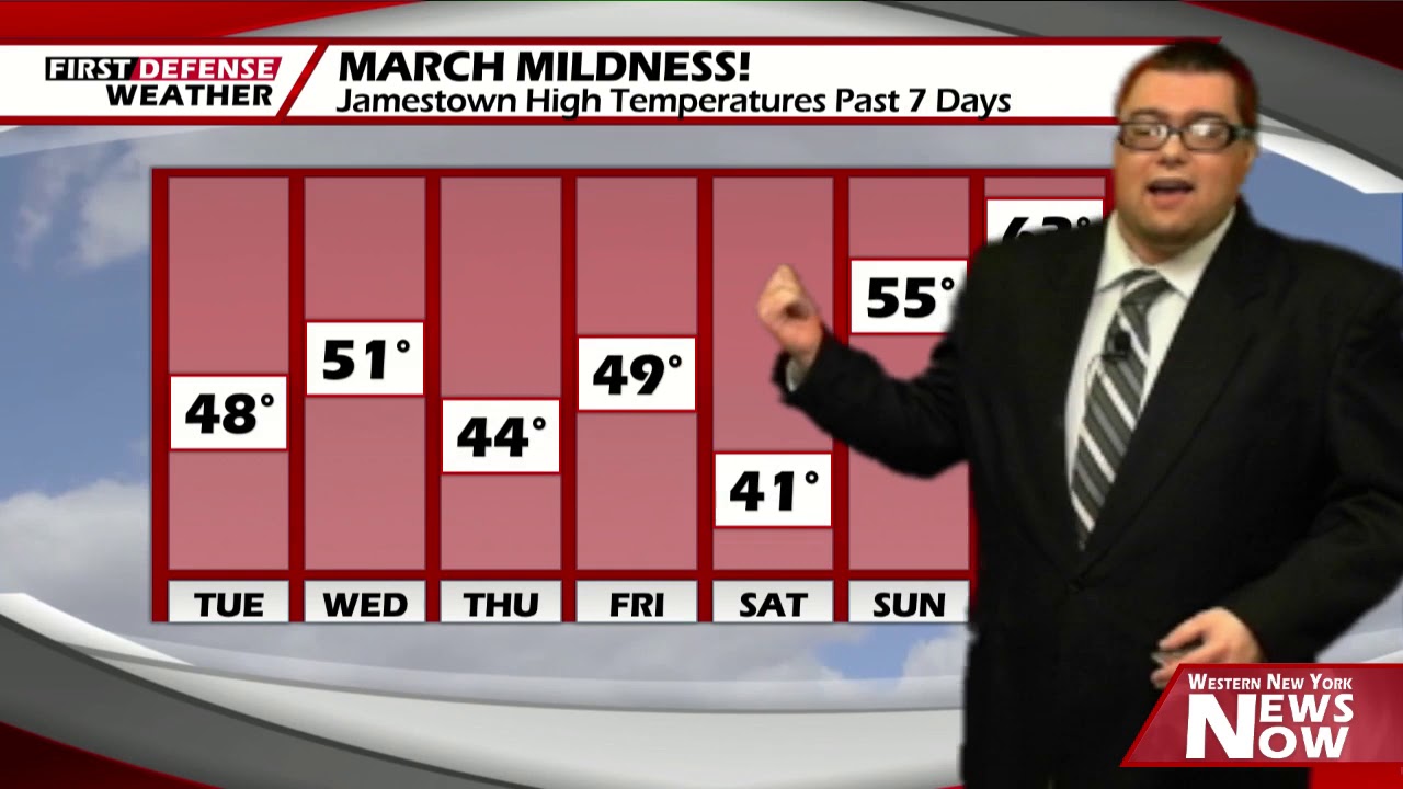
High temperatures for the day have already occurred. The official high in Jamestown was 56, which occurred at 2 a.m. this morning. Since then, temperatures have slipped back through the 40’s and we will likely end the day in the lower to mid 40’s. There could be some moderate to heavy downpours at time as well.

It will also be breezy with a west-southwest wind 15 to 30 MPH with some gusts that could reach upwards of 35 MPH.
Rain showers will come to an end early tonight with skies partially clearing after midnight. Lows 22 valleys, 29 lakeshore.
While the sun will peak out from time to time tomorrow, there is a 20 to 25 percent chance of an isolated rain shower in the afternoon. Highs 41 to 47.
Thursday will be another mainly dry with highs nearing 50 once again.
Another storm system pulling north of us into Canada will likely scrape the region on Friday brining another shot of rain showers into the region. We’ll be on the warmer side of that storm which will equate out to our daytime highs in the mid to upper 40’s.

We will dry our nicely for the weekend into early next week with partial sunshine each day and temperatures in the lower to mid 40’s.
WNYNewsNow is a proud Ambassador for the NOAA Weather-Ready Nation program.
![]()


Leave a Reply