App users, tap here to watch video.
JAMESTOWN – While the rain has come to an end, it will still be windy at times this afternoon. High pressure returns over the weekend leading to a nice but cooler stretch of weather before warming back up again next week.
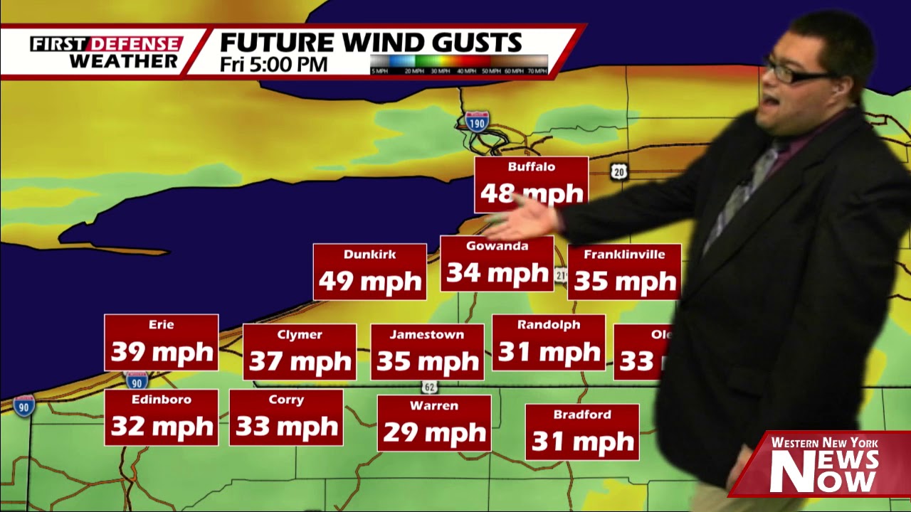
The National Weather Service maintains a Wind Advisory for Chautauqua County until 11 p.m. tonight. The overall strongest winds will likely be found near the Lake Erie shoreline and the higher hills of the Southern Tier.

High temperatures for the day have already occurred early this morning. As a cold front moves through the region overnight, temperatures have falling into the upper 30’s to lower 40’s with a more west to northwest wind. Temperatures will not be budging much through the afternoon either.
The clouds will continue parting this afternoon leading to partly to mostly sunny skies. However, the winds will still be kicking up 15 to 30 MPH with gusts upwards of 45 MPH in spots.

Skies will become partly to mostly clear tonight with the winds settling down after midnight. Wind gusts early could be near 40 MPH. Morning lows 27 valleys, 33 lakeshore.
With the rerun of high pressure, the weekend will be nice and dry with a good amount of sunshine to go around each day. However, with a more northerly wind on Sunday, that will likely keep us into the mid to upper 30’s through the day.

We will return to above average temperatures next week with a good bill of health through much of the week. There is a chance for a few rain showers both Tuesday and Thursday but nothing major in the cards for the foreseeable future.
WNYNewsNow is a proud Ambassador for the NOAA Weather-Ready Nation program.
![]()


Leave a Reply