App users, tap here to watch video.
JAMESTOWN – While the rain has ended for the day, clouds will be clinging over areas inland away from Lake Erie. A few showers will take us through the remainder of the week before a more impactful storm heads our way for the weekend.
With a southerly wind flow aloft, most of us should see temperatures near average for this time of the year, despite the cloud cover. Highs will range 44 on the highest hills to 56 near Lake Erie.
Clouds will hang around throughout the night tonight but will not quite as chilly as it has been in recent nights. There will be a bit of a breeze around 15 MPH especially after midnight. Lows 36 valleys, 43 lakeshore.
Tomorrow, for the most part, will be a near carbon copy of today. An isolated morning shower with partial afternoon clearing. However, a better chance for a few scattered showers will be possible across the Southern Tier later in the afternoon while becoming much warmer. Highs 52 to 60.
With a frontal boundary stationed over the region, we will keep the chance for a couple spotty showers later Thursday night and early Friday with highs nearing 50.
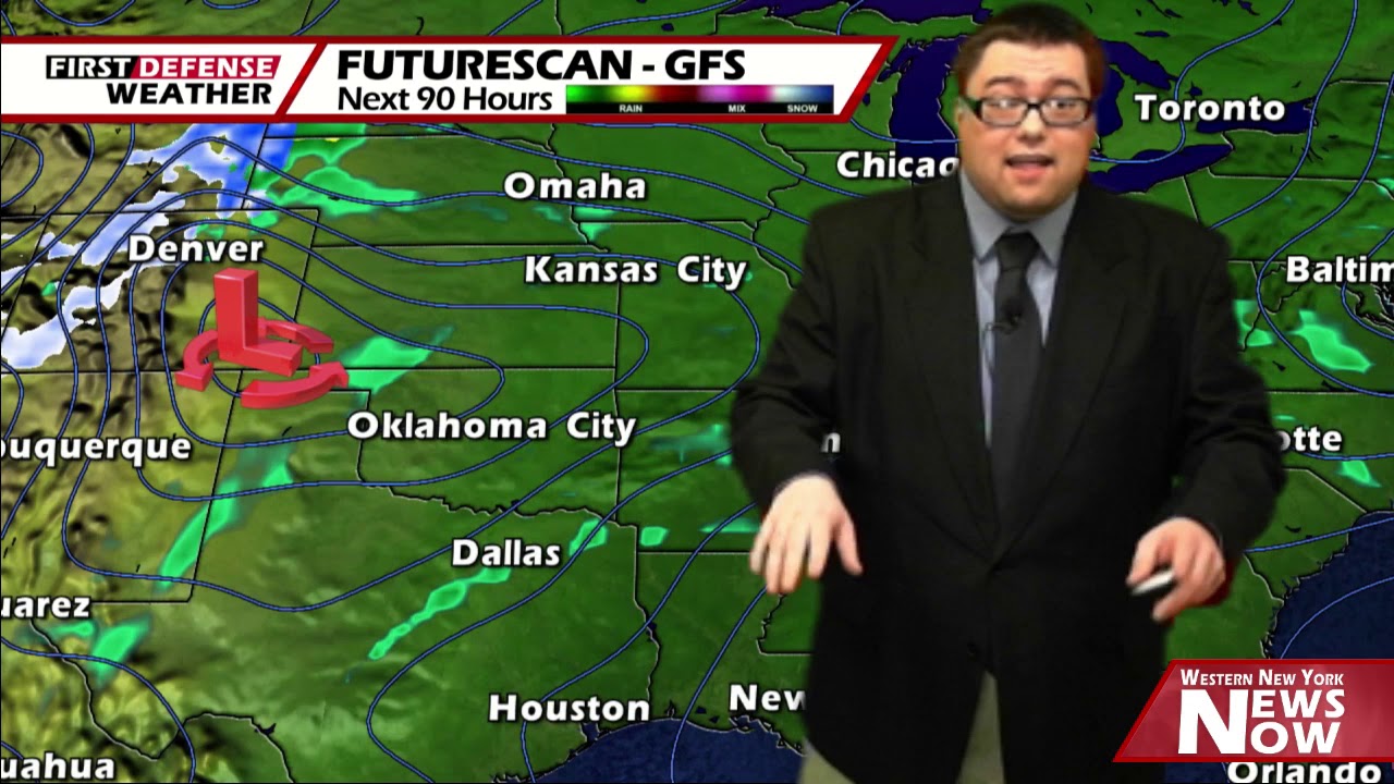
Our attention turns to the weekend where a developing storm system will likely impact us Saturday and Sunday with widespread rain. Keep in mind, this storm hasn’t gotten organized yet and even as great as computer model guidance is these days, they tend to handle storms better once they actually take shape.
With that being said, there is enough confidence with the primary global models to roughly map out a projected path. The storm will likely develop somewhere near the Texas Panhandle and move through the midwest and ending up the upper Great Lakes.

The potential does exist for some moderate to heavy rain both days during this point along with a healthy southwest breeze. Saturday will likely be cooler in the lower to mid 40’s while we’ll spike back into the mid 50’s on Sunday.
At this point, there does remain questions in regards to the exact track and how close the center of the storm will ride to the region. This will be the deciding point in terms of precipitation timing and rainfall intensity.
High pressure returns early next week with partial sunshine and highs in the lower 40’s through Tuesday.
Looking down the road into Voodoo Country, models are hinting at a deep storm system moving through the region late next week that could bring us a wave of snow and wind Thursday and Friday.
Understand, this is well over a week out and it is scientifically impossible and socially irresponsible to through out any details at this point in time, given the unknown if this storm will develop at all. However with several of the long-range models showing this, it does make it worth noting as at least a possibility.
WNYNewsNow is a proud Ambassador for the NOAA Weather-Ready Nation program.
![]()


Leave a Reply