UPDATE: Chautauqua County Tornado Classified As EF1, Reached Max Wind Speed Of 100
JAMESTOWN — Several tornado warnings were issued in Chautauqua and Cattaraugus Counties Thursday evening, bringing substantial rain and even damage to some areas.
Strong to severe storms passed by the region with heavy rain, lightning, gusty winds, and a few possible tornado’s.
The National Weather Service at 4:19 p.m., reported a severe thunderstorm capable of producing a tornado was located near Evangola State Park, or 13 miles east of Dunkirk, moving northeast at 20 m.p.h.
Then at 5:50 p.m. another severe thunderstorm capable of producing a tornado was located near Falconer, or near Jamestown, moving east at 25 mph.
As of 7:40 p.m. both have moved out of the area.
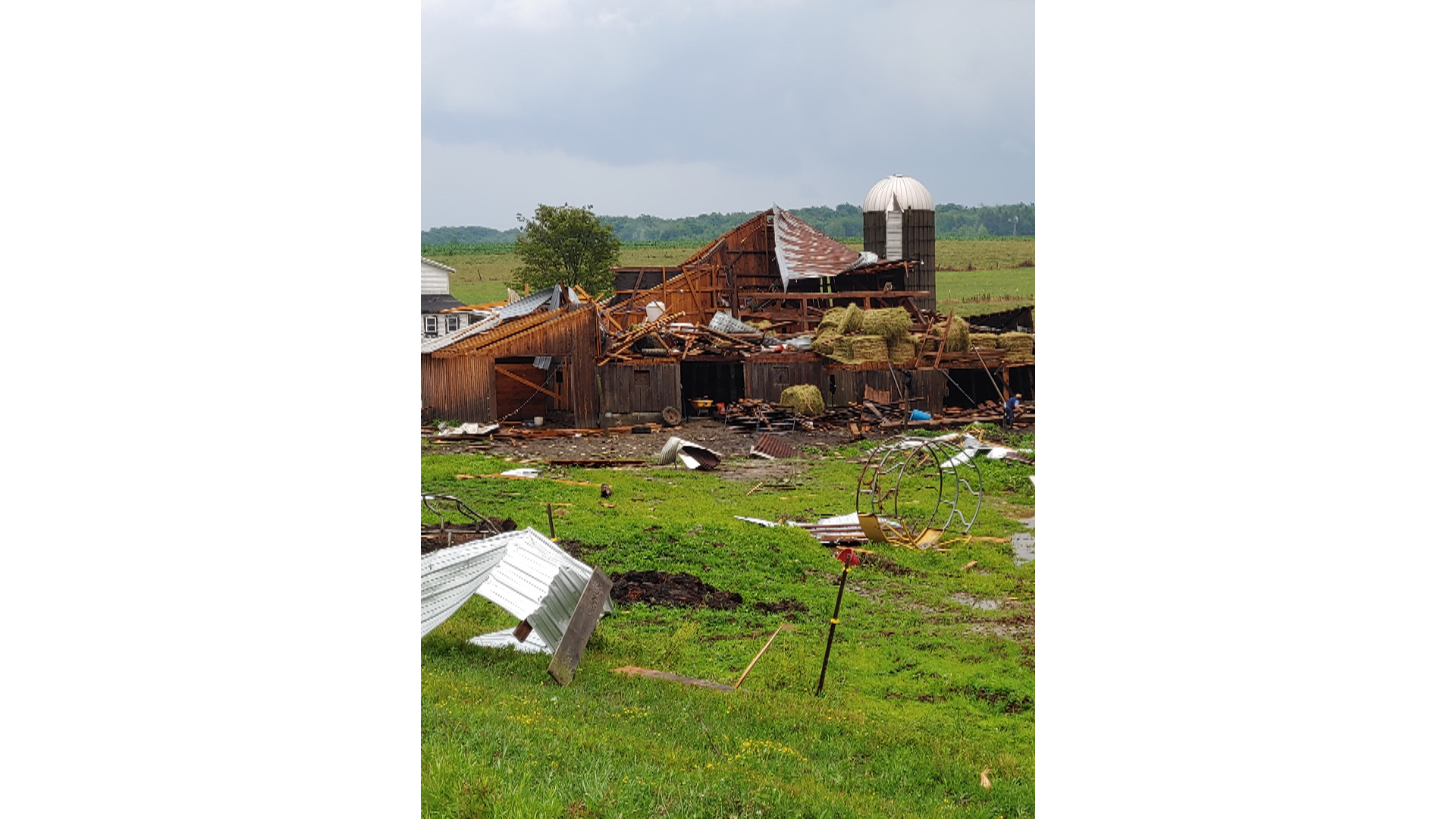
Crews with the weather service may inspect the area in the coming days to determine if there was a tornado(s) and how strong they were, or if damage was caused by straight line winds.
Photos of possible tornado damage was taken near Mayville in the second batch of storms.


These storms also produced heavy tropical like rainfall with up to 2 inches in some spots.
For the remainder of the evening it will quiet down. A severe thunderstorm watch remains in an effect until 9 p.m. That may likely be dropped early as the storms move out. Otherwise it will be cloudy tonight with a few showers possible and lows in the upper 60’s.


Leave a Reply