App users, tap here to watch video
JAMESTOWN – The muggies are back with very oppressive humidity but its duration will be short as we back it down throughout the week with an upcoming pattern flip.
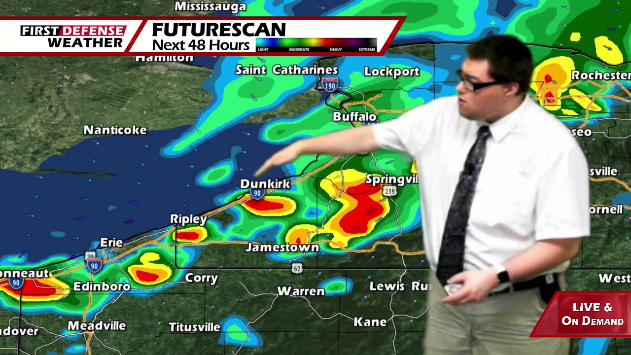
The very high amounts of humidity in the air will be the driving source for some scattered showers and thunderstorms this afternoon and evening. The NOAA Storm Prediction Center has placed far western Chautauqua County and Northwestern Pennsylvania under a low-end Marginal Risk, a level 1 out of 5, for severe thunderstorms.

While not impressed with the overall setup today, one or two storms could be elevated with gusty winds and vert heavy, near tropical-like rainfall. Flooding could become a concern in spots where storms do fire up throughout the day. Highs 82 at the Lake Erie shoreline, 88 well inland. Health southwest beezee’s 10 to 20 MPH.
As a Cold front moves through tonight, more widespread showers and thunderstorms will be likely overnight. While there won’t be a chance for any severe activity, these storms could be heavy with downpours possible. It will stay rather mild and muggy before the frontal passage. Lows 65 valleys, 73 lakeshore.
After the passage of the front, the humidity levels will start to drop as more refreshing air is pulled into the region with a more west-northwesterly wind flow aloft. We’ll cling into a few showers and storms for the morning with a good supply of sunshine setting up for the afternoon. Highs 76 to 84.
A couple showers and storms will be possible Wednesday through Friday but overall precipitation chances remain rather low in the 25 to 40 percent bracket each day. There will be plenty of dry time as well with partial sunshine. Highs in the upper 70’s to around 80.

The weekend as we stand now, is a bit in limbo and will be determined on the track of storm system that could either brush the region or move directly over the region. We’re airing on the drier side for both Saturday and Sunday for now with high near 80 each day.
WNYNewsNow is a proud Ambassador for the NOAA Weather-Ready Nation program.
![]()


Leave a Reply