App users, tap here to watch video
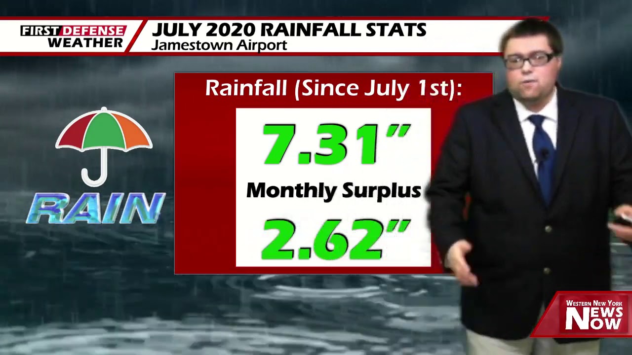
JAMESTOWN – Even though July has been a rather wet month, we will end it on a quieter and comfortable note before showers and thunderstorms make a return over the second half of the weekend.
A Cold front has been slow to move through over the past couple days which have sparked the showers and thunderstorms we’ve been dealing with. However as the front moves through, more refreshing air will be pulled into the region with a high sliding down into the region the at least the first half of the weekend.
It will be rather nice tonight with partly to mostly cloudy skies. Cooler and less humid. Lows 55 in the valleys, 65 at the Lake Erie shoreline.
As an area of high pressure builds into Western New York on Friday, that will clear out the cloud cover leading to a good supply of sunshine to go around while remanding comfortable. Highs 76 to 83.
We’ll keep that great weather going straight into Saturday with highs 76 to 82.
A storm system pulling into the Great Lakes will bring the return of scattered showers Saturday night with a slight uptick in overall humidity. Lows in the lower 60’s.
As the associated low moves close to the region on Sunday, widespread showers and thunderstorms will be possible across the region with a brief influx of humidity. As of this time, we’re not expecting any severe weather out of this system. Highs near 80.

Scattered showers and storms are still possible on Monday as we’ll still be wrapped in the wind flow as the storm system pulls way. Highs in the upper 70’s.
A return to cooler and less humid air will make a comeback through the middle of next week with partial sun and a small chance for a shower or storm both Tuesday and Wednesday. Highs in the mid to upper 70’s.
WNYNewsNow is a proud Ambassador for the NOAA Weather-Ready Nation program.
![]()


Leave a Reply