App users, tap here to watch video.
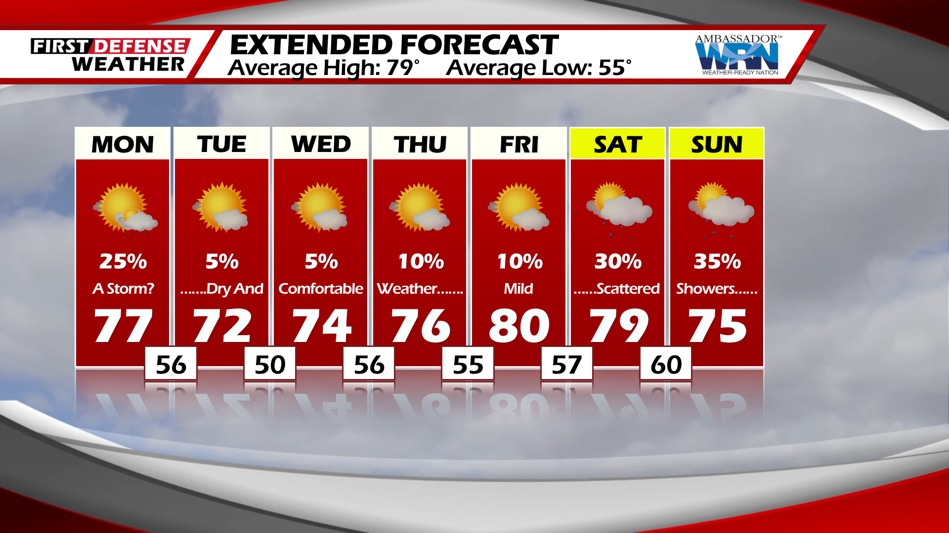
JAMESTOWN – A cold front will pass the region today, in its passing a cooler dryer pattern will set up for the remainder of the week.
For this afternoon, partly to mostly cloudy skies with a scattered shower or storm possible. Highs in the upper-70’s.
Tonight, partly cloudy with a scattered shower possible. Lows in the mid-50’s.
A cooler air mass sets up starting tomorrow. Other then a stray shower, partly cloudy skies with highs in the low to mid-70’s.
Wednesday and Thursday will continue with sunny skies and temperatures in the low-70’s. Lows at night will drop back into the low to mid-50’s at night with some areas well inland reaching the upper-40’s.

Temperatures rebound to near 80 by the weekend as another system approaches the area.
WNYNewsNow is a proud Ambassador for the NOAA Weather-Ready Nation program.
![]()


Leave a Reply