
App Users, Tap Here To Watch Video
JAMESTOWN – After the passage of a cold front, cooler temperatures are in store for the next few days. High pressure will provide for mainly dry weather over the weekend.
For this afternoon, lake effect rain showers will taper off leading to clearing skies. Highs around 50.
The National Weather Service has issues a Frost Advisory for Chautauqua and Southern Erie Counties from 12 A.M tonight until 9 A.M tomorrow morning
Otherwise tonight will be mainly clear with lows around 30 inland to the upper-30’s near the lakeshore. An area of lake effect rain showers will set up mainly over Lake Erie and the Buffalo Niagara area.

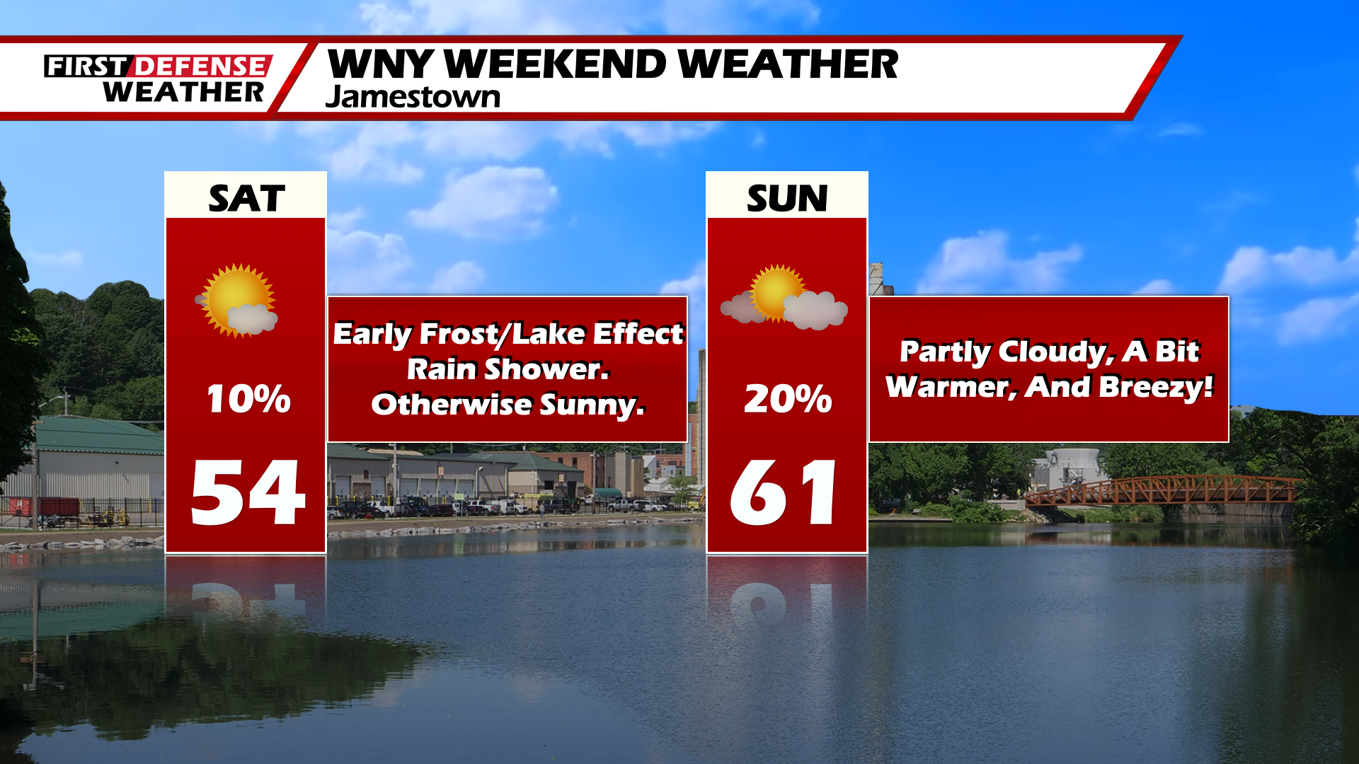
High pressure will keep the weekend mostly dry and sunny. A lake effect rain shower is possible early Saturday morning along with areas of frost. Highs on Saturday in the lower-50’s.
Sunday will still be mainly dry but it will be breezy. Highs reaching the low to mid-60’s.
As of now, next week looks unsettled with a series of systems moving by the area. Model guidance remains uncertain with the timing of these systems as well as a passing cold front. So each day through mid-week will feature a chance of rain with highs in the low to mid-60’s.
WNYNewsNow is a proud Ambassador for the NOAA Weather-Ready Nation program.
![]()


Leave a Reply